Intertidal Polyphonies
Pages
-
-
Dung Kai Chung Interview
-
This Audio recording discusses Dung Kai Chung’s Atlas and the interplay between maps and language. The interview shifts to how maps construct a reality of a place and the imaginative aspects of mapmaking. It then concludes with the topic of Hong Kong’s coastline and land reclamation and how these changes alter the perception of transnationalism within the space., 0:14
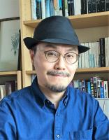
Dung Kai Cheung: My name is Dung Kai Cheung. I am a Hong Kong writer. I was born here, grew up here, yeah. And I write fiction, yeah…(laughing) I write stories.
0:28
Joanne Leow: (laughing) Thank-you. I wanted to talk to you about Atlas. In the introduction to Atlas you say it’s a verbal collection of maps, so I wanted you to talk a little bit more about that relationship between the words, the—you know, this idea of verbal language, and maps, like how are they connected for you?
0:49
Dung Kai Cheung: I think there’s some similarity between the two things, although apparently they look very different, but they are…language actually a system of signs, and map is obviously made up of signs. Signs, lines, some conventions on how to represent something. So both of them are representations of some so-called reality. Of course, language is more flexible. We can use language to talk about many things, nearly everything, but for maps, maybe the language or the symbols that the maps employ are more limited in a sense. But the…although those signs are more limited, they are also very rich and there is much room for imagination. So for me when I look at maps, I do not take them as tools. Of course I also take them as tools (laughs), if I go travel I need to look at maps, and with the help of maps find a way, but when I look at maps while I wrote this book, The Atlas, I took them as a kind of language.
2:22
Joanne Leow: Was there one moment or one map in particular that really inspired you to start writing the book? Was there one moment where you were like, okay. Can you trace back to one moment where the book was inspired from one particular image or map?
2:36
Dung Kai Cheung: Well, maybe not a particular map but a particular collection of maps. Yeah, this very good, big and thick collection of historical maps of Hong Kong. It was compiled in the colonial days by an Englishman—I’ve forgotten his name—and he worked in the Hong Kong government in lands department, something like that. He was an expert in that, and so he did this collection, a collection of all the old maps that he could find on Hong Kong, both made by the Chinese or by foreigners. And so in that collection there is about more than fifty maps in total, maybe, yeah. And so a very fascinating thing, when I first came across this book, I think in a bookstore, a government bookstore selling government publications. Those things seem to be very boring stuff, but actually there are many interesting things inside.
4:00
Joanne Leow: Yeah. And so, did the maps contradict each other? Did they sometimes not say the same thing?
Dung Kai Cheung: They never say the same thing, especially for the older maps.
Joanne Leow: Yeah.
4:10
Dung Kai Cheung: If you compare the Chinese maps with the English or the foreign maps, you’ll see everything is different (laughs), yeah even the shape of the island, or, you know, other things. You can’t recognize the same thing. And so, in this difference or discrepancies between these maps, I felt very strongly that maps are not a representation of reality, but a construction of reality, or the construction of the reality from the perspective of the mapmaker.
4:51
Joanne Leow: I just want to hold you there for a second, think about the map space of Hong Kong, because I went to the City Gallery yesterday, and I noticed that they have these superimpositions of maps of Hong Kong as the land reclamation wore on and on and on. So what are your views on that, like literally the coastline has changed so much, I mean, the contours of it just become more straight, more static, to reclamation.
Dung Kai Cheung: Yeah, yeah.
Joanne Leow: So what are your thoughts on that in connection to the work that you do?
5:16
Dung Kai Cheung: Yeah, yeah. That, for me, that process is like a constant invention of the city, you know, it’s not just so-called urban development in the usual sense, but that’s the shape, or the condition of what it is, this city keeps changing. So it’s just like the city is being invented and re-invented again and again, and when you look at the maps alone and see the different stages, it’s like you are looking at a creative process in the manipulation of signs, and the way of portrayal of the city. It’s like reading a novel or a fictional work.
6:14
Joanne Leow: So the city itself becomes a text, but it’s also the representation of the city.
Dung Kai Cheung: Yeah.
Joanne Leow: How do you relate, then…you know how we all talk about maps are fictions, maps are ways of expressing language, how do you relate that in your work to the actual physical space where you live? Because obviously every day you’re living in Hong Kong, deal with Hong Kong, right?
6:33
Dung Kai Cheung: Yeah.
Joanne Leow: So what, in your mind, is that relationship between all these representations that you’re talking about and the actual, political, material reality of Hong Kong?
6:42
Dung Kai Cheung: Yeah. We usually see maps in this way: that there is the reality, the actual state of the place, and then some mapmakers go make measurements and then try to give us a very loyal and actual representation of that reality. But when we look at maps, especially historical maps, actually we see that there is—maybe the reality is projected onto that place, especially if a government is planning the reclamations and land development, actually the reality originates in the planning and not in the reality. So, you have first the planning, or the intention of doing something to the land, and then you project this idea onto the land and make changes to that. And so, I think maps are also a representation of this will on reshaping or changing the place to one’s own expectations or other intentions.
8:02
Joanne Leow: And what do you think, then—I mean, what I really think is really interesting about the text, then, there’s all this uncertainty about time. Like it’s set in the future, but you’re looking back to this past, which is our present…
Dung Kai Cheung: Yeah, yeah (laughs).
Joanne Leow: …you use a temporal, a wonderful idea. Why did you choose to do it that way, in terms of thinking of time and maps? And, you know, obviously you wrote around ’97, that’s obviously very crucial, right, so can you tell me a little bit more about your idea of time in the text?
8:33
Dung Kai Cheung: Yes. Well, maybe I want to talk about not just the past and the present at the time when I wrote the book as if everything has become history. So I want to look back at the present, you know, to put distance between myself, writing self, and the subject matter. And so I imagine that it is written by somebody in the future and they look back. And I also want to take about—take away the so-called reality, so the assumption of the whole book is that the place called Hong Kong has disappeared, it’s no more, even geographically or in reality. But then all people have is just these documents, and so they try to reformulate or reinvent the city by reading and imagination, yeah.
9:45
Joanne Leow: Why did you feel the need to have that? It’s so interesting, you’re using a spatial metaphor again, right?
Dung Kai Cheung: Yeah, yeah.
Joanne Leow: To have that distance, that detachment, at that moment in ’97. Was there an impulse where you were just like, “I can’t deal with this right now,” was that it? Or why do you decide to distance yourself that way?
10:06
Dung Kai Cheung: I think it will give more room for interpretations and imaginations. If we are in the present moment and dealing with things that is happening right now, somehow there isn’t much room for you to imagine that things could be otherwise, or radically different. But if you put it into the past, a long last past, and you have only limited resources or documents at hand, then suddenly that becomes—open up a lot of space, and explore the areas that you feel free to play with. That’s something that you cannot do at the very close distance, yeah. That’s why I felt, later when I wrote other novels and other stories, sometimes I try to get closer to the reality that I’m living in, and I felt this constraint on my imagination. And so, maybe it’s just my own habit that I am used to doing this, that is to create a time distance between the moment of writing and the subject matter.
11:36
Joanne Leow: That’s so interesting because I—and when you’re saying constraints, maybe it’s the constraints of this idea that you have to feel…you have to describe everything accurately, right, because it’s around you—
Dung Kai Cheung: Yeah, yeah.
Joanne Leow: —whereas if you don’t have to, it’s just like…. Do you think that your work, then, in Atlas, is kind of a fundamentally optimistic or pessimistic view of Hong Kong’s future?
12:03
Dung Kai Cheung: I never thought of whether it is pessimistic or optimistic. It’s open to interpretations, yeah, if you look—take the idea that Hong Kong has disappeared, is no more, then maybe you feel that it’s pessimistic (laughs). But if you look at it from another perspective, that a place can always be reinvented, that you can always put in something different and new to its history, then that could be optimistic.
12:41
Joanne Leow: Kind of the afterlife of the city is in the text.
Dung Kai Cheung: Yeah, yeah.
Joanne Leow: Like it survives in all these documents.
Dung Kai Cheung: Yeah, yeah.
12:48
Joanne Leow: I think one other question I really want to ask you, just in relation to my own research—I’ve been thinking a lot about the trans-Pacific and the coastlines, and how Hong Kong is connected to things across the ocean, or other parts of Asia. When you think about the coastline of Hong Kong, changing coastline, and the kind of transnational connections that it has—there’s one particular section in Atlas where you’re talking about this particular map where what Hong Kong imports and exports, it radiates out, like this beautiful set of arrows, so just in relation to that, how do you think, maybe even given the current time, Hong Kong’s position as a kind of transnational city is changing or has changed in your lifetime?
13:32
Dung Kai Cheung: Yeah. I think we can interpret coastline metaphorically. So, it is not only the physical condition, or the physical outline of a place, coastline is also a kind of line of contact with the outside, with somewhere else and with somebody else. In that case, Hong Kong is—has always been—a place where this contact with the outside influence is very active and always…or even interactive, and always changing, yeah. And so I do not want to define the identity of Hong Kong as something that is inside, you know, I mentioned that in a piece called Geological Strata, you know, things like that, yeah. And so, especially now, after twenty years now of the handover, we have been—we are now talking very much about localism or something essential, some Hong Kong qualities, the Hong Kong nature that is, you know, an essence that is not to be violated by outside influence, by influence from China; I never believe in that thing. I think it—we do not have an essence or a true Hong Kong inside. What Hong Kong is, is Hong Kong as it is interacting with what is non-Hong Kong, or what is outside Hong Kong. So I will understand coastline metaphorically as this line which is constantly moving and changing.
15:44
Joanne Leow: Yeah. That’s really interesting when you think about coastline as well, the coastline itself changes, not just because of reclamation, which obviously it is, but because of the interti—the tides, right, the tides, there’s this intertidal point where—it’s not even a line anymore, it’s kind of a zone.
Dung Kai Cheung: Yeah, yeah.0:14
Dung Kai Cheung: My name is Dung Kai Cheung. I am a Hong Kong writer. I was born here, grew up here, yeah. And I write fiction, yeah…(laughing) I write stories.
0:28
Joanne Leow: (laughing) Thank-you. I wanted to talk to you about Atlas. In the introduction to Atlas you say it’s a verbal collection of maps, so I wanted you to talk a little bit more about that relationship between the words, the—you know, this idea of verbal language, and maps, like how are they connected for you?
0:49
Dung Kai Cheung: I think there’s some similarity between the two things, although apparently they look very different, but they are…language actually a system of signs, and map is obviously made up of signs. Signs, lines, some conventions on how to represent something. So both of them are representations of some so-called reality. Of course, language is more flexible. We can use language to talk about many things, nearly everything, but for maps, maybe the language or the symbols that the maps employ are more limited in a sense. But the…although those signs are more limited, they are also very rich and there is much room for imagination. So for me when I look at maps, I do not take them as tools. Of course I also take them as tools (laughs), if I go travel I need to look at maps, and with the help of maps find a way, but when I look at maps while I wrote this book, The Atlas, I took them as a kind of language.
2:22
Joanne Leow: Was there one moment or one map in particular that really inspired you to start writing the book? Was there one moment where you were like, okay. Can you trace back to one moment where the book was inspired from one particular image or map?
2:36
Dung Kai Cheung: Well, maybe not a particular map but a particular collection of maps. Yeah, this very good, big and thick collection of historical maps of Hong Kong. It was compiled in the colonial days by an Englishman—I’ve forgotten his name—and he worked in the Hong Kong government in lands department, something like that. He was an expert in that, and so he did this collection, a collection of all the old maps that he could find on Hong Kong, both made by the Chinese or by foreigners. And so in that collection there is about more than fifty maps in total, maybe, yeah. And so a very fascinating thing, when I first came across this book, I think in a bookstore, a government bookstore selling government publications. Those things seem to be very boring stuff, but actually there are many interesting things inside.
4:00
Joanne Leow: Yeah. And so, did the maps contradict each other? Did they sometimes not say the same thing?
Dung Kai Cheung: They never say the same thing, especially for the older maps.
Joanne Leow: Yeah.
4:10
Dung Kai Cheung: If you compare the Chinese maps with the English or the foreign maps, you’ll see everything is different (laughs), yeah even the shape of the island, or, you know, other things. You can’t recognize the same thing. And so, in this difference or discrepancies between these maps, I felt very strongly that maps are not a representation of reality, but a construction of reality, or the construction of the reality from the perspective of the mapmaker.
4:51
Joanne Leow: I just want to hold you there for a second, think about the map space of Hong Kong, because I went to the City Gallery yesterday, and I noticed that they have these superimpositions of maps of Hong Kong as the land reclamation wore on and on and on. So what are your views on that, like literally the coastline has changed so much, I mean, the contours of it just become more straight, more static, to reclamation.
Dung Kai Cheung: Yeah, yeah.
Joanne Leow: So what are your thoughts on that in connection to the work that you do?
5:16
Dung Kai Cheung: Yeah, yeah. That, for me, that process is like a constant invention of the city, you know, it’s not just so-called urban development in the usual sense, but that’s the shape, or the condition of what it is, this city keeps changing. So it’s just like the city is being invented and re-invented again and again, and when you look at the maps alone and see the different stages, it’s like you are looking at a creative process in the manipulation of signs, and the way of portrayal of the city. It’s like reading a novel or a fictional work.
6:14
Joanne Leow: So the city itself becomes a text, but it’s also the representation of the city.
Dung Kai Cheung: Yeah.
Joanne Leow: How do you relate, then…you know how we all talk about maps are fictions, maps are ways of expressing language, how do you relate that in your work to the actual physical space where you live? Because obviously every day you’re living in Hong Kong, deal with Hong Kong, right?
6:33
Dung Kai Cheung: Yeah.
Joanne Leow: So what, in your mind, is that relationship between all these representations that you’re talking about and the actual, political, material reality of Hong Kong?
6:42
Dung Kai Cheung: Yeah. We usually see maps in this way: that there is the reality, the actual state of the place, and then some mapmakers go make measurements and then try to give us a very loyal and actual representation of that reality. But when we look at maps, especially historical maps, actually we see that there is—maybe the reality is projected onto that place, especially if a government is planning the reclamations and land development, actually the reality originates in the planning and not in the reality. So, you have first the planning, or the intention of doing something to the land, and then you project this idea onto the land and make changes to that. And so, I think maps are also a representation of this will on reshaping or changing the place to one’s own expectations or other intentions.
8:02
Joanne Leow: And what do you think, then—I mean, what I really think is really interesting about the text, then, there’s all this uncertainty about time. Like it’s set in the future, but you’re looking back to this past, which is our present…
Dung Kai Cheung: Yeah, yeah (laughs).
Joanne Leow: …you use a temporal, a wonderful idea. Why did you choose to do it that way, in terms of thinking of time and maps? And, you know, obviously you wrote around ’97, that’s obviously very crucial, right, so can you tell me a little bit more about your idea of time in the text?
8:33
Dung Kai Cheung: Yes. Well, maybe I want to talk about not just the past and the present at the time when I wrote the book as if everything has become history. So I want to look back at the present, you know, to put distance between myself, writing self, and the subject matter. And so I imagine that it is written by somebody in the future and they look back. And I also want to take about—take away the so-called reality, so the assumption of the whole book is that the place called Hong Kong has disappeared, it’s no more, even geographically or in reality. But then all people have is just these documents, and so they try to reformulate or reinvent the city by reading and imagination, yeah.
9:45
Joanne Leow: Why did you feel the need to have that? It’s so interesting, you’re using a spatial metaphor again, right?
Dung Kai Cheung: Yeah, yeah.
Joanne Leow: To have that distance, that detachment, at that moment in ’97. Was there an impulse where you were just like, “I can’t deal with this right now,” was that it? Or why do you decide to distance yourself that way?
10:06
Dung Kai Cheung: I think it will give more room for interpretations and imaginations. If we are in the present moment and dealing with things that is happening right now, somehow there isn’t much room for you to imagine that things could be otherwise, or radically different. But if you put it into the past, a long last past, and you have only limited resources or documents at hand, then suddenly that becomes—open up a lot of space, and explore the areas that you feel free to play with. That’s something that you cannot do at the very close distance, yeah. That’s why I felt, later when I wrote other novels and other stories, sometimes I try to get closer to the reality that I’m living in, and I felt this constraint on my imagination. And so, maybe it’s just my own habit that I am used to doing this, that is to create a time distance between the moment of writing and the subject matter.
11:36
Joanne Leow: That’s so interesting because I—and when you’re saying constraints, maybe it’s the constraints of this idea that you have to feel…you have to describe everything accurately, right, because it’s around you—
Dung Kai Cheung: Yeah, yeah.
Joanne Leow: —whereas if you don’t have to, it’s just like…. Do you think that your work, then, in Atlas, is kind of a fundamentally optimistic or pessimistic view of Hong Kong’s future?
12:03
Dung Kai Cheung: I never thought of whether it is pessimistic or optimistic. It’s open to interpretations, yeah, if you look—take the idea that Hong Kong has disappeared, is no more, then maybe you feel that it’s pessimistic (laughs). But if you look at it from another perspective, that a place can always be reinvented, that you can always put in something different and new to its history, then that could be optimistic.
12:41
Joanne Leow: Kind of the afterlife of the city is in the text.
Dung Kai Cheung: Yeah, yeah.
Joanne Leow: Like it survives in all these documents.
Dung Kai Cheung: Yeah, yeah.
12:48
Joanne Leow: I think one other question I really want to ask you, just in relation to my own research—I’ve been thinking a lot about the trans-Pacific and the coastlines, and how Hong Kong is connected to things across the ocean, or other parts of Asia. When you think about the coastline of Hong Kong, changing coastline, and the kind of transnational connections that it has—there’s one particular section in Atlas where you’re talking about this particular map where what Hong Kong imports and exports, it radiates out, like this beautiful set of arrows, so just in relation to that, how do you think, maybe even given the current time, Hong Kong’s position as a kind of transnational city is changing or has changed in your lifetime?
13:32
Dung Kai Cheung: Yeah. I think we can interpret coastline metaphorically. So, it is not only the physical condition, or the physical outline of a place, coastline is also a kind of line of contact with the outside, with somewhere else and with somebody else. In that case, Hong Kong is—has always been—a place where this contact with the outside influence is very active and always…or even interactive, and always changing, yeah. And so I do not want to define the identity of Hong Kong as something that is inside, you know, I mentioned that in a piece called Geological Strata, you know, things like that, yeah. And so, especially now, after twenty years now of the handover, we have been—we are now talking very much about localism or something essential, some Hong Kong qualities, the Hong Kong nature that is, you know, an essence that is not to be violated by outside influence, by influence from China; I never believe in that thing. I think it—we do not have an essence or a true Hong Kong inside. What Hong Kong is, is Hong Kong as it is interacting with what is non-Hong Kong, or what is outside Hong Kong. So I will understand coastline metaphorically as this line which is constantly moving and changing.
15:44
Joanne Leow: Yeah. That’s really interesting when you think about coastline as well, the coastline itself changes, not just because of reclamation, which obviously it is, but because of the interti—the tides, right, the tides, there’s this intertidal point where—it’s not even a line anymore, it’s kind of a zone.
Dung Kai Cheung: Yeah, yeah.
Pages